Sunday, October 31, 2010

Heading South, and Sun in November!

Written/Posted 2:50 PM, Monday, November 1st, 2010
Huntly, in the Waikato

We left the Coromandel Peninsula this morning, after camping last night at Whangamata. We had a nice night in the campground we stayed in last week (and a proper shower!), and shared dinner and breakfast with a girl from Northern Ireland who was traveling on her own. We're on our way south to New Plymouth, and are currently stopped in Huntly, not too far north of Hamilton, and on the beautiful Waikato River (which, we just found out, supplies 50% of New Zealand's electricity). We're fans of Huntly, especially since it has a laundromat (all, and I mean ALL, of our clothes and linens were dirty) and a gorgeous library with free internet.

I forgot to post a few other photos from Kennedy Bay:
 The black pig was caught wild. 

 A swim in the estuary

K Bay with truck, beer bottles, and pig dogs :) 

While the nights are cold, the weather is remaining on our side- beautiful sunny days that have me totally turned around, since November back home is the opposite of this. Yesterday on our way south we stopped at Cathedral Cove Marine Reserve and took the walk down to Mare's Leg Cove, to some of the most astonishing scenery I've seen yet. While our experiences on the Coromandel were mixed, there's no doubt that it is an absolutely beautiful place. Here are some photos:
(Click to enlarge)


 Me and the gateway to Narnia (you might recognize it from the Prince Caspian movie...)


View back across the beach at the archway.

We're not really sure what the next few days will look like, but I will update in due time- maybe we'll have work of some kind by then (one can hope, right?). Until then, Happy November to you all!

Saturday, October 30, 2010

3 Days in the Wop-Wops


Written 12:00 PM Saturday, October 30, 2010
Kennedy Bay, Coromandel Peninsula

Posted 4:30 PM, October 31st (Happy Halloween!), Whangamata

Well, our experience of the last few days has certainly been a different one. We have only lasted a little over three days at the organic farm in Kennedy Bay, in remotest backwoods New Zealand. I thought I was from the backwoods, but where we ended up for our workstay turned out to be even more remote than where I grew up, and we were given relatively little warning. It hasn’t all been a bad experience, but we aren’t going to gain much by staying longer, so we’re heading out tomorrow to make our way to the Taranaki region to look for paid work and maybe stay in one situation for a couple months.

So here’s the saga: after leaving Whitianga on Wednesday afternoon, we came to Coromandel town via the most terrifying road I had been on to that point in my life. No more than a lane and a half, gravel, no guardrails when you need them, and curves so tight that I repeatedly thought we would scrape the sides of the van if we had to pass someone there. Matt was at the wheel, and managed it admirably, but we are now in agreement that we will no longer take any of the roads marked in orange in our atlas. Unfortunately, the only way to get where we were going on the other side of Coromandel township was on another one of these roads. We were told that the farm was “near Coromandel town” and the directions we were given were to “follow the gravel road over the hill towards Kennedy Bay for 20 minutes.” It turned out that these directions were rather deceptive, given that it took us around 35 minutes to get over the hill, and this road now claims the title of most terrifying I have ever been on. We had the presence of mind to turn on the video function on the camera, but I cannot get blogger to post the video, so I'll have to figure out that one later. 

There were some great views from either side of the top of the pass, but I can only think that living on this side of the mountain means trouble when there is a medical emergency, and I can hardly imagine a schoolbus coming down that road every day. It is beautiful in its own way, but getting to town is such a chore that it’s just a little too remote for me.

 Above: Coromandel town and Hauraki Gulf from the top. Below- Kennedy Bay and the road we drove to get down into that valley.


After our harrowing drive, we found the farm and pulled in, to find that the situation was rather different than advertised, or rather that we had not been given the proper expectations. It turned out that our accommodations were our own van, parked at a campsite in the bush, a 30 minute hike from the house via a 45% grade quad track, or by our host driving us over the long way via the main gravel road. To get to the campsite, we had to make our way through eerily deep muddy ruts in the road, and by driving through the river. Yes, through it:


Our welcome was an evening trip down to the beach, which was beautiful, and since everyone else had eaten dinner, while they drank we were handed a wok and some eggs and ham to fry up over the fire. The longer we’ve been here, the more disenchanted we’ve gotten. I appreciate the different lifestyle to some extent, but I find it hard to keep up when there is no particular schedule for the day, and food comes sporadically, and we seem to be given more booze than actual food for our payment. I haven’t learned anything new about gardening or farming as I had hoped, and the work has been very hard physical work. Yesterday we worked for about six hours, clearing out the old overgrown orchard, weedwhacking (I operated a weedeater for the first time in my life, so I guess that’s a new skill), mulching, and digging huge holes for rotten fish leftovers that our host had obtained for fertilizer. Given that we were told we would be doing 2-3 hours of work per day, we’re not feeling that it’s entirely fair to work such hard work for such long hours in exchange for a campsite that we’ve had to put a lot of work into just to make livable, and our meals tend to be whatever we can cobble together from the box of food our host drops off every couple of days. I’m a planner, and like to know what to expect, and our host does most things by the seat of her pants, and changes plans on us all the time, so it’s difficult for me. Matt and I were already both feeling pretty uncomfortable with the setup, and when yesterday’s lunch wasn’t ready until two hours after we were told it would be, and the afternoon’s “a few beers on the beach” turned into a drunken rager and our only way home was in a truck with a driver who had had a few drinks, we decided it was probably time to go. We’re not gaining anything by being here, besides a good glimpse of how we don’t want to live.

I’m trying not to be judgmental, and I don’t want to sound so disapproving; it’s simply not how I want to live, and we were given no previous notice that this was how it would be. Our host is obviously happy with her lifestyle and has some great things going on, and I’m sure there are many WWOOFers and workers who will come here and have a great time, and I’m glad for that. If we were given more of a set schedule and proper expectations, I think we could enjoy it too, but we’re also hampered by the fact that we can’t easily get to town and have any time on our own, and it’s pretty much expected of us to go along with whatever drinking or partying is going on, with little notice, so we don’t feel like we have a lot of freedom.

There are definitely some fun things about being here- I don’t want to sound totally negative. We are camped with three other workers, all of whom are awesome and a lot of fun. Jamie and Kate are a couple from London, also with a campervan, who just arrived in New Zealand after 5 months in South America. Nick is from Florida and is finishing up a six month stay in New Zealand. We have had a really great time with all of them and will be exchanging emails and hopefully staying in touch. They are all hard workers, and they fit more easily into the lifestyle here, so I’m really glad for them on that account- I wish I could enjoy it as much as they do, but it’s just not how I’m wired. The campsite is rad in its own way, but it’s hard to fight the feeling that we’re squatting on the back forty. We’ve done a lot to fix it up- we suspect that since our host has only reclaimed the farm in the last few months, we are the first batch of workers she’s had, because the campsite wasn’t particularly habitable when we got here.

 The bamboo shower block that Jamie built. Just needs a solar shower now.


 Jamie and Nick cooking dinner.
 Fire ring that we built on our first night.
 Kate painting the outhouse, after I swept all the cobwebs out of it (me being the only one of the five of us who isn't freaked out by spiders).


 Today we are stranded in camp because it’s raining and because our host wanted us to work here today, since she’s too hungover to do anything on the farm. But it’s been raining all morning, so I’m in the bach here (colloquial for one room camping shack), with some candles going (no electricity-glad I had the laptop charged up), at least managing to do something productive. Matt and I made the decision this morning that we’ll head out and back over the mountain tomorrow morning, and stay off the orange roads forever after that. We had thought that we would be near town, so that we might be able to work on finding paid work, but we are so cut off from everything here that it’s nearly impossible to get a start on that. We’ve only had one (soapless) shower since we got here, and it’s really difficult to get laundry done, and hard to keep the van clean, so we’ll have our work cut out for us getting things cleaned and reorganized once we hit civilization again.

Once again, I’m sorry for the rant- there’s positive parts of this experience, but mostly I feel like I’m wasting my time here. I find it really hard to respect many aspects of the way our host lives, and we’ve already seen her and her family exhibit racism and homophobia and some other behaviors that are really not in line with our values. But I am glad for her that she has reclaimed the land- her father owns it and abandoned the farm 30 years ago, so the fruit trees are all established and just need to be made healthier, and she is already earning money from her roadside stand and by selling via the market in town. They do well on the self-sufficiency front, sourcing most things for free, hunting wild pigs for meat, and growing so much fruit and veg fresh. I’ve had wild pork and mutton and loquats for the first time, and been introduced to some new recipes, but today we’re in camp eating our own food and cooking it with our own fuel because she hasn’t given us any new supplies.

So tomorrow morning (Sunday) we’ll make our way out and start wending our way towards New Plymouth, the biggest city of the Taranaki region in the southwest of the North Island, where hopefully there will be jobs, and where there is almost always surf! I will always look back on these last few days as a learning experience, and hopefully be able to laugh at it looking back (honestly, we already are laughing at the ridiculousness of some of it).

Tuesday, October 26, 2010

North to the Coromandel


Written 10:40 AM Oct. 27th
Posted same afternoon

Still high on the achievement of doing the Tongariro Crossing, but with our bodies complaining loudly about the mileage of the previous day, we took it pretty easy on Sunday and Monday. We had a leisurely morning on Sunday on the Tongariro River, then did a short and mellow hike to Lake Rotoponamu to stretch our aching legs, and then took a wonderful soak at the thermal mineral pools at Tokaanu, just south of Turangi. The pools are DOC-owned (Department of Conservation, pronounced “Dock”) and managed by the local Iwi (tribe) and got us so blessed out it was hard to do much but sit around in the shade afterward. We did do the short and free thermal walk near the pools after lunch, and then started our drive north. 
 Click on photos to enlarge
 Lake Rotopounamu

 Manuka flowers

Some views from the thermal walk:


Taupo was hopping with tourists on the sunny holiday weekend, so we basically just drove straight through town and out the other side, heading north through the South Waikato region and into the Shire. The area around Tokoroa and north is flattish green farmland, gorgeously bright, and definitely inhabited by hobbits. We drove through Matamata, with Hobbiton (seriously- the set for Hobbiton is still there) somewhere in the green a few kms off the highway. After four hours of driving, we found ourselves back at the Dickey Flat free campsite in the Karangahake Gorge, where we camped our very first night out of Auckland- full circle, and exactly one month later. This time, we found it full of campers on the last of their holiday weekend, and got to know a couple of our fellow campers, in particular a lonely-seeming character of a Kiwi who wandered over and told us all about the local area, how to catch fish and collect shellfish, and advised us to get an air rifle so we could “pop off some rabbits.”

On Monday we drove to the coast via Waihi, where we stopped at the campsite guy’s advice to look at the giant Martha Pit Mine, right in the center of town. This is a gold and silver mine, and the size is astonishing, and rather terrifying.

As you can see, it's too big to fit in a camera lens...

We finally made it onto the Coromandel Peninsula, ending up in Whangamata (fahn-guh-muh-TAH), which was hyped up as a surfer’s paradise, but we found it packed with loud beach partiers, and no surf whatsoever. With prices in town the most expensive we had seen ($1 for 7 minutes of internet) and all the “surf shops” staffed by teenagers who knew very little about surfing, we got out of town to a DOC campsite that turned out to be really lovely. Freedom camping is prohibited on the Coromandel Pensinsula (one of few places in New Zealand where it is enforced), and we were a little reluctant to actually pay for camping, but the cheeriness of the camp manager and the beauty of the site made up for it. It was just us and a German couple our age with a campervan, who we chatted with, and we had a lovely sunny afternoon and morning there. 

The scenery on the Coromandel is much more dramatic than what we've seen up till now. Here's a few views:
 The pinnacles of the Coromandel Range.

 Beach and islands at Tairua

 Matt on the beach at Whangamata

Yesterday we visited Bob Anderson, a surfboard shaper in Whangamata, where I found a secondhand board for a bargain price, and put it on hold. It needs some repairs, so we’ll go back through there in a week or so and pick it up. Then we headed north via Tairua to Hot Water Beach, which was definitely the highlight of the Coromandel for us so far. Not to far off the highway, there is a section of this public beach where the sand is heated by volcanic activity 2 km below, and you can rent a shovel from the general store there and go dig yourself a hot tub on the beach! The day was gorgeously sunny, the scenery amazing, and the hot water HOT!


The whole thing was rad, in a totally bizarre way. A beach full of people soaking in steaming holes, with the ocean just a few feet away! After soaking for an hour or so, we took a jump in the ocean, which was only refreshingly cold, and felt great!

We came up here to Whitianga (fit-ee-AIN-guh, apparently) in the late afternoon, and camped here at the holiday park, also owned by a super friendly couple, and were we had showers, a full kitchen, and most of the empty park at our disposal.

This evening we’re heading to Kennedy Bay, north of Coromandel Town, to the organic farm which is our next workstay. We haven’t been given a lot of information about the situation there, so we’re not sure how long we’ll end up staying, but I will definitely let you know when I know!

Hope you’ve all enjoyed the stories and pictures, and as usual, thanks so much for traveling vicariously with us! 
 Living the dream.

Traverse of the Tongariro

Written 10:15 AM, Oct. 27th, 2010
Posted same afternoon

Saturday, the 23rd, saw us start and complete “the greatest day hike in New Zealand,” and according to some, the best in the world. 50,000 people per year hike the Tongariro Crossing, and we were lucky enough to do it in the off-season, in incredibly good conditions and with relatively few fellow hikers (probably only about 400). The Tongariro Crossing (tong-uh-REER-oh) is a one-way hike, in at one trailhead and out at another, so a few people arrange their own transportation (i.e. someone to pick them up at the end) and drive up to the trailhead, but most, like us, take a shuttle that will pick us up at the end of the day. Lyn had strongly recommended that we go with Tongariro Expeditions, which turned out to be a great choice. Their policy is that they won’t take people up to the hike if conditions aren’t good, and they won’t put people on the mountain if they wouldn’t want to be there themselves. Other companies take people up no matter the conditions, just for the money, which is shameful. The conditions on the TC can be very extreme, and can change rapidly. Lyn has done it several times and has some pretty gnarly stories of 50 km/hr winds and sub-freezing temperatures that come in quickly on a day that started warm and balmy. We were so pleased that the weather gods finally handed us a perfect day- maybe two clouds in the sky the entire day, and sun sun sun and only a small amount of wind on the way down. We met a Danish guy from Auckland at our lunch stop, who had done the TC a number of times in all seasons, and said this was the best conditions he had ever seen up there- lucky us!

We were up at 6 AM to get to the Turangi I-Site, where the expedition bus picked us up and shuttled us to the Mangetepopo trailhead, which was hopping with people, at 8 AM! The staff on the bus gave us info sheets about every segment of the trail, maps, and the essential timelines for the hike- the last bus would leave the Ketetahi trailhead on the other side at 4:30, so it was essential that we leave certain points at certain times to make sure we made it back for our pick-up. Most people hike the whole traverse in 6-8 hours (we did it in exactly 7 hours), and the company did a really great job of letting us know what to expect, and explaining the TC’s “point of no return”- the climb up Red Crater Ridge, not quite halfway in. Basically, if you get to that point and are feeling unfit or having trouble, you turn around before you get to the climb up the ridge, but if you start up the ridge and start feeling bad, you have to keep going, because the other side is more sheltered, and it’s really hard to go back down the ridge, just best to keep going. They also had every type of hiking gear available for use- hiking boots, jackets, raingear, packs, hiking poles, the whole bit. We were given so much information about how to prepare and what kind of gear to bring that we were amazed to see the lack of sense that many people up there had in regards to clothing and gear- running shoes, cotton workout pants, leather jackets, all kinds of things that could get you killed if the weather changed. We chose to borrow hiking poles (in reality, old ski poles, but they worked just fine), which were free to use, and hit the trail at about 8:20 AM.

I’ll do most of the rest of this post in photos, but I’ll explain the route a little bit- the trail goes in on the flank of Mt. Ngaurahoe (naur-uh-HOO-ee), then up the Devil’s Staircase to the South Crater, then straight through the South Crater, which is dead flat, to the climb up Red Crater Ridge, then around the rim of Red Crater, which is windy, but the ground is warm to sit on (thermally heated). From Red Crater Ridge it is a steep climb down on scree and slush to the Emerald Lakes, then through the enormous Central Crater to Blue Lake. From the edge of Blue Lake, the trail starts to zigzag sidehill down to the Ketetahi Hut, and then from the hut it is about a two hour walk downhill on the north face of Mt. Tongariro past Ketetahi Hot Springs (privately owned) and then through some lowland bush to the Ketetahi Trailhead and the end of the crossing. From here, I’ll let the pictures do most of the talking (I had a really hard time choosing only a few, so I apologize if it's a little bit of overload here):
 Click on photos to enlarge

Mt. Ruapehu on the drive up. 

 Matt heading up the trail.


 Me and Ngaurahoe (otherwise known at Mt. Doom. Look familiar?)

 View of Mt. Ngaurahoe from the south crater

Matt in the South Crater
 Through the crater

 Looking back over south crater. You can't really see it here, but Mt. Taranaki on the southwest coast was in the distance- you can see coast to coast on a clear day from the summit of the TC.

 Rimeice (spelling?) created from wind exposure

 Not sure this photo shows how gnarly the climb up to Red Crater ridge was.

 View into Red Crater from the summit of the crossing.

View from the top. You can see a piece of Mt. Ruapehu to the left of Ngaurahoe.


 Note the steam vents behind me. The cone of Mt. N was also venting some steam. 

 The scree trail down from the ridge. 

View to the Emerald Lakes and edge of the central crater. 

 This view back into the Red Crater through the Central Crater was my favorite view of the whole hike. 

 A couple views of the alpine vegetation for Mom and Dad. I'm pretty sure the pointy green leaves belong to a type of alpine daisy.


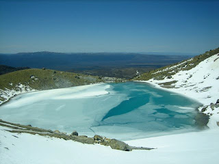
 Blue Lake was frozen.
 Hiking on snow down the other side. 
 The trail winding down to the Ketetahi hut. The near lake is Lake Rotaira, and the far one is the end of Lake Taupo.
 
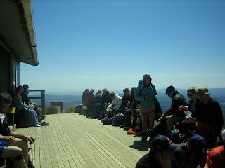
High on endorphines and the hut.
Matt and Mt. Tongariro. One hour to go!

 Wacky fern on the final bush section of the hike. 

We did it!

The whole thing was an amazing experience, spectacular views and quite a multicultural social experience as well. We chatted with two guys from Auckland on our way up the Devil’s Staircase, befriended a Swedish guy named Sebastian on the walk through the South Crater, and I ended up becoming the hero of an Asian girl who we first met at the bus pick-up, and who was slipping around and terrified on the climb up Red Crater Ridge. I ended up loaning her one of my hiking poles for that climb, and giving her some advice about where to place her feet, and we kept running into each other and saying hi for the rest of the hike, and she insisted on getting me on video as we hiked past Blue Lake J

It was an incredible day, we were absolutely knackered at the end of the day but very pleased at how our bodies held up (I was very pleased to have underestimated how in shape I was- turns out all that physical work on the farm got me fit enough to hike 12 miles in alpine country in 7 hours!) We showered that evening at a Holiday Park in Turangi, and treated ourselves to an amazing dinner at a local restaurant before returning to our riverside campsite, where we found two German guys van-camping as well, so we chatted with them for awhile before hitting the hay.

I think the Tongariro Crossing is probably my greatest physical achievement to date, and the challenge of it was as thrilling as the scenery and the very fact of hiking through massive volcanic craters. Matt and I both had a great time, and I’m pretty sure it ranks up there in the top 5 or 8 days of my entire life. For serious.